
Covington ZIP Coverage at a Glance
Official sources clearly support one core Covington mailing ZIP. A second nearby ZIP can appear in broad geographic results, but its precise Covington edge was not fully confirmed through the official USPS city output. The table keeps that difference visible instead of presenting a false citywide list.
| ZIP | Area served | Postal facility | Boundary note |
|---|---|---|---|
| 98042 | Main Covington mailing area and city addresses | Covington Branch | Official branch record confirms the Covington ZIP and address |
| 98038 | Nearby Maple Valley and possible Covington-edge results | Maple Valley-area service | Verify each address; not every 98038 address is inside Covington |
The USPS Covington Branch is at 17300 SE 270th Place, Covington, WA 98042-9998. That confirms the branch and postal code, not every city-limit edge or resident. Use the USPS address lookup for a particular address.
Search Covington ZIP Codes Precisely
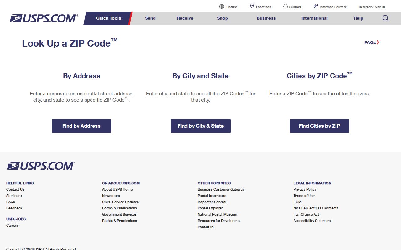
USPS offers three search modes. The address form is strongest when a street number is known. A city-and-state search returns ZIP information for that postal place, while Cities by ZIP returns recognized city names for one code. The public form does not confirm that a person or company receives mail at the result.
| USPS mode | Required fields | Optional fields | Useful result |
|---|---|---|---|
| By Address | Street, city, state | Company, unit, ZIP | Standardized address, ZIP, recommended city |
| By City and State | City, state | None noted | Postal codes associated with the city |
| Cities by ZIP | ZIP | None noted | Recognized city names for that ZIP |
The captured USPS lookup page shows those official search choices.
Copy the standardized output as shown. Do not replace the recommended city name with a preferred local label before comparing other records.
Find Covington Records by ZIP
A postal area can narrow the search, yet no verified public eReal, PermitTrax, or voter tool was found that returns every Covington owner or voter by ZIP. Use postal data as one step in a source-by-source search.
- Run the complete address through USPS and save the recommended city and ZIP. Include a unit when one is known.
- Open King County iMap, locate the parcel, and compare the city-boundary layer with ZIP5 and postal-city metadata.
- Take the parcel number to eReal Property for situs, mailing, tax-account, and assessment facts. Keep situs and mailing addresses separate.
- Use the Recorder, permit office, or Elections only for the precise record sought. Follow each office's own access rules.
Once the area is narrowed to a named road, the Covington street directory process explains how to follow parcels by address. A ZIP-wide match never proves occupancy.
Read Covington Postal Fields in GIS
King County and city GIS asset data separates postal and municipal labels. ZIP5 stores a five-digit postal value. POSTALCTYN is the postal city name, CTYNAME identifies the city field, and ADDR_FULL stores the complete address. These fields can disagree without either record being wrong because they describe different systems.
| Map field | Meaning |
|---|---|
| ZIP5 | Five-digit postal code attached to the mapped asset |
| POSTALCTYN | Postal city name used for mail |
| CTYNAME | Municipal city-name field |
| ADDR_FULL | Full mapped street address |
Use the layer name and retrieval date with any screenshot or note. Postal, precinct, school, fire, and subdivision boundaries can all change on different schedules. GIS metadata is not a voter filter and does not create a Covington residents list.
Note: Treat a ZIP mismatch as a geography result and record which agency supplied each label.
Covington ZIPs and City Limits
A Covington mailing address can sit outside the incorporated city, and an incorporated parcel may carry a postal city label that differs from local branding. USPS routes mail. King County iMap locates parcel geometry and the city line. The Assessor and Recorder connect that land to tax accounts and legal instruments. City planning staff decide current municipal development and permit questions.
For an edge address, check each part on its own: USPS city and ZIP, parcel geometry, incorporated boundary, permit jurisdiction, and voter jurisdiction. Never use a city-branded mailing line alone to choose a records custodian. No official ZIP split year or citywide postal population table was located, so this Covington coverage summary does not invent one.
Boundary check. USPS address result → King County parcel → incorporated-city layer → Assessor or Recorder record.
- ZIP
- A five-digit USPS mail-routing code, not a city boundary.
- ZIP+4
- A more precise delivery segment added to the five-digit code.
- PO-box ZIP
- A code assigned to post-office box delivery in a postal area.
- Unique ZIP
- A code assigned to one organization or facility with enough mail volume.
- Carrier route
- A delivery path used by a postal carrier; it is not a neighborhood border.
Old Covington Roads Predate ZIPs
Covington became a city on August 31, 1997, after a November 1996 vote. Earlier records may say unincorporated King County or identify a rural road, farm, railroad stop, precinct, or township. A modern five-digit mail code can therefore be the wrong key for an older directory, census, deed, or newspaper search.
The 2023 community history links SE 240th Street with North Road, SE 256th with Middle Road, and SE 272nd with South Road. Kent-Kangley Road aligns with SR 516, while SR 18 follows older transport paths. Search the old and current names together. A rural route or crossroads may lead to a plat and legal description when the modern street number produces no result.
Historical reverse directories are address keyed, but Covington coverage is not continuous. Pair any entry with a map, plat, census geography, and date. The postal code should not be projected backward into an era that used another address system.
Separate Covington Address Types
Three address labels often appear in a parcel search. The situs is the physical parcel location. The mailing address is where the tax notice goes and may belong to an owner elsewhere. The postal address is the USPS-standardized delivery line. A legal description uses plat, lot, block, section, township, range, or other land terms rather than a mailing label.
Keep all four in separate notes. If a modern street search fails in Recorder records, use the parcel number, full party name, legal description, document type, and date. Landmark's index begins in 1976, most online images begin August 1, 1991, and parcel indexing was inconsistent until about 2002. Older material may require Recorder staff, mailed copy procedures, or King County Archives microfilm.
A parcel or mailing address can identify an owner connection. Neither proves that all people who receive mail, visit, or appear in a related record live at the Covington address.
Cross-Check Covington Neighborhood Labels
Subdivision and park names can refine the area when postal labels are broad. Covington plans name places such as Aqua Vista at Pipe Lake, Maple Hills, Timberlane Estates, Winterwood Estates, and many other HOA parks. These names are geographic clues, not public member rosters.
Plat history matters too. Aqua Vista Estates was filed in 1961, and most surviving Covington homes were built after 1960. A house in a later subdivision cannot appear under its current address in an earlier directory. Search the plat name, developer, early lot deed, and nearby historic roads before calling the record absent.
Other Covington plats include Suncrest Park, Squires Estates, Covington Homes, Crystal View, Fir Manor, Hart's Addition, Meridian Court, Shadow Glen, and Victoria Glen. Their names can appear in deeds, assessor cards, permits, and local histories even when a postal search uses only a numbered street. Pair the subdivision with the lot, block, and legal description. That combination is more durable than a postal code when tracing land through a change in street labels.
ZIP, school attendance area, precinct, fire district, HOA, and parcel lines need not match. For every map-based conclusion, retain the date and named layer. That simple habit prevents a current boundary from being imposed on a historical household.
Limits of a Covington ZIP Lookup
USPS can standardize an address and postal city, but it does not confirm a person or company there. GIS shows geography, not occupants. The assessor connects a tax account and owner to a parcel, while the voter file follows election law and protected-address rules. Permit records document work or code activity, not a household roster.
No verified public portal produces all Covington residents in 98042 or the uncertain 98038 edge. A responsible postal directory stays at the address and area level, then moves to the official record whose interface and law permit the intended search. Protected voter data, private utility accounts, sealed files, and household details remain outside that process.
When a public interface does not accept a ZIP filter, do not force a broad result into postal groups. Search one address or parcel, or send the custodian a narrow request for an existing, disclosable record. Covington Permit Services can address city permit questions, while King County keeps parcel, deed, voter, and many court sources. Each office supplies its own date, scope, and access limits. Save those details with the postal result so the evidence stays clear.
Use complete addresses and dated records for family history, property research, or civic questions. Never convert a postal match into a claim about where a named person currently lives.